Grodzka Street
Kraków, POLAND
CENTRAL europe
NOVEMBER 14-19, 2011


Grodzka Street
Kraków, POLAND
CENTRAL europe
NOVEMBER 14-19, 2011

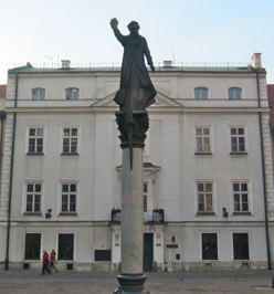
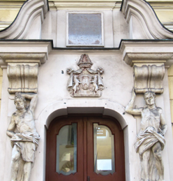
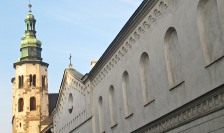
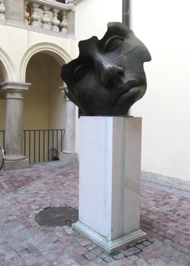
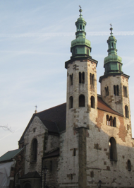
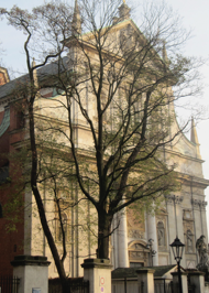
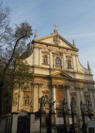
Grodzka Street is one of Krakow’ oldest streets, following an important north-south section of a medieval trading route that existed even before the city received its charter in 1257. The trade route was along the salt route that lead to Wielczka, Myslenice, and south to Hungary. Originally, the street ended at the fortifications of an old settlement known as Okót, predating Kraków. When Okót became part of Kraków in the 14th century, the street was already lined with solid houses. The charming Mary Magdalen Square opens to connect Grodzka street with Kanonicza Street has a sculpture in its center facing the Baroque Jesuit Church of St. Peter and St. Paul, c. 1619. Nearby, also on Grodzka Street stands the Romanesque church of St. Andrew’s c. 1090. The walls of the Poor Claire Nunnery parallel the street creating a formal barrier. The Collegium Iuridicum, its 17th century interior courtyard framed by arches, contains an interesting bronze sculpture, an example of its ongoing contemporary exhibitions.
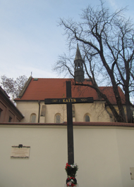
PHOTOS: Top Three: 1. The Baroque Church of St. Peter and St. Paul c. 1619. 2. A sculpture of Piotr Skarg stands in Mary Magdalen Square opening Grodzka Street to Kanonicza Street. 3. The Katyn Cross, a memorial that commemorates the Polish victims of the Stalinist regime, stand next to the wall of the Church of St. Giles on Grodska Street at the foot of Wawel Hill. Middle Three: 1. Façade of the Church of St. Peter and St. Paul c. 1619. The Baroque architecture includes figures at each column of the iron fence surrounding the church. 2. The entrance to the Cervantes Institute. 3. The courtyard of the Collegium Iuridicum, one of the oldest university buildings. Its late Gothic style was extended in the Baroque Period. The contemporary bronze sculpture in the 17th century arcaded interior court is an example of ongoing sculpture exhibitions. Bottom Two: 1. St. Andrew’s Church, c. 1090. 2. The eastern frontage of Poor Claire Nunnery along Grodska Street with the Romanesque towers of St. Andrew’s Church in the background.

Historic Salt Trade Route